Antennas, Antenna Cables, Wireless Products: Technical Articles
GPS Applications in IoT (Internet of Things)
Table of Contents
Key Characteristics of GPS make it critical to a variety of Mobile IoT Solutions
Location of objects: GPS (part of the broader Global Navigation Satellite System – GNSS) uses a constellation of medium Earth orbit satellites to provide highly accurate positioning data. Modern IoT devices often support multi-constellation GNSS (GPS, GLONASS, Galileo, BeiDou) to improve availability, accuracy, and time-to-first-fix.
- Calculation of speed: This ability of GPS is reliant on the constant transmission of satellite signals as the GPS satellites make their routine 12 hour orbits around the earth. The movement of the target object or device relative to satellite position can be used to compute velocity using the traditional equation: speed=distance/time.
- Precise timekeeping: The function of GPS satellites is underpinned by powerful atomic clocks that are used in the data processing critical to the system's correct performance. These synchronized and stable embedded clocks are corrected daily to ensure the accuracy of timekeeping necessary for GPS to perform properly.
- GPS Accuracy and Performance
Enhance with:
- Typical civilian accuracy: 2–5 meters (open sky)
- With SBAS (WAAS/EGNOS): <1 meter
- With RTK: centimeter-level accuracy
- TTFF definitions:
- Cold start: 30–120 seconds
- Warm start: 20–40 seconds
- Hot start: 1–10 seconds
- Direction: Ephemeris data released by GPS satellites can be used to compute the direction and orientation of objects relative to the satellite's orbital position.
- The sheer computational power of this celestially-based radio navigation system means that end-user military, civilian and commercial applications are immediately enhanced by the extensive data processing capabilities of this system.

When paired with IoT, GPS provides the ability to quantify and record large amounts of data pertaining to time, location, speed and direction. This complementary relationship enables the characterization of terrestrial movement:
- of objects
- of goods
- of animals
- of people
Which has major economic implications and the potential to create smart cities and the currently theoretical Internet of Everything (IoE).
Applications of GPS in IoT technology
Where used as a standalone technology, GPS use will be on the basis of its time transfer, location and movement monitoring capabilities.
GPS is primarily used for location or tracking applications which are reliant on the triangulation of the orbiting satellites on a GPS tracking antenna and receiver in the object or device in use. Once accurately pinpointed, there is continual calculation of position and regular updates to track objects that are in motion using microwave data transmission.
GPS enabled IoT devices include:
- Navigational aids
- Location and tracking devices which can be embedded or attached to everyday consumer objects such as a dog collar or school bag. This technology can also be used to track valuable assets such as cargo being shipped internationally.
- Wearables used by employees, personnel, convicts or patients to monitor their activity.
- Geofencing: The creation of GPS monitored boundaries as a security measure (e.g. for pets) or to enforce a curfew.
- Accurate timestamping of transactions or movements
- Synchronization with digital devices, watches and clocks for accurate timekeeping.
Why GPS Is Foundational to Mobile IoT
- Enables digital twins of physical assets
- Enables predictive logistics
- Enables compliance reporting
- Enables automation workflows
- Enables geo-analytics and AI models
GPS antennas for embedded product design

Successfully performing GPS-based IoT applications are reliant on a suitably performing GPS antenna. GPS signals are not exceptionally strong, therefore an embedded GPS antenna needs adequate exposure to be able to receive signals from as many satellites as possible to provide the necessary relay of data to the attached Global Navigational Satellite System (GNSS) receiver.
Optimal GPS performance is reliant on the strongest satellites having a carrier to noise power density ratio in the range of 44 to 50dBHz at a minimum. Typical GPS antennas exceed this. Other functional characteristics of an optimally performing GPS antenna include:
- High gain
- Low noise LNA
- Low directivity
- Good exposure to the sky
- Appropriate impedance matching between antenna and cable.
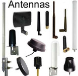
For GPS-based applications, a wide range of types of antenna are available, which can be embedded as part of the device design. Key types of GPS antenna include:
- Dipole antenna
- Patch antenna
- Chip antenna
- Helix antenna
- Fractal element antenna
- High end GNSS antenna
Mounting of these antennas is of critical importance to allow full exposure to the sky allowing for visibility to as many satellites as possible.
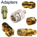
Different antenna types offer varying characteristics that can impact signal reception. For instance, patch antennas often require careful positioning for optimal sky visibility, while chip antennas embedded within devices might benefit from specific grounding considerations. These factors, along with the antenna's size and radiation pattern, all influence its performance. In many cases, the chosen antenna type will necessitate the use of a specific RF connector for a secure and functional cable connection. Examples of common antenna cable adapters used in antenna applications include SMA, RP-SMA, MMCX, and U.FL connectors.
Additional Critical GPS Antenna Parameters
- Axial ratio (important for circular polarization)
- Right-Hand Circular Polarization (RHCP compatibility)
- Ground plane size requirements (especially for patch antennas)
- Phase center stability (for high-precision GNSS)
- Active vs Passive antennas
- LNA gain typically 20–30 dB
- Noise figure < 1.5 dB preferred
GPS operates at L1 (1575.42 MHz), and modern GNSS also supports L2 and L5 bands for improved accuracy and multipath mitigation.
Combining GPS with 4G / LTE
The combination of GPS and 4G / LTE technology provides the ability to create novel wireless and positioning solutions. This is achieved with varying success by integrating GPS with the Global System for Mobile Communications (GSM); cellular communications technology that encompasses protocols such as 4G.
The union of GPS and 4G is not an easy one due to teething problems with the cold start time for GPS. This involves the time taken for a GPS device to locate the relevant satellite orbit and clock data to be able to calculate the necessary position, which is known as a 'fix'. Time To First Fix (TTFF) for GPS can range from a few seconds to several minutes, depending on the environmental conditions and terrain the device is in. Cold starting also consumes a lot of energy which can hamper the use of GPS in IoT applications.
Cellular communications networks are being used to overcome this delay by creating an adapted form of GPS known as 'Assisted' GPS. A-GPS looks to close the time gap on achieving the initial fix by supplementing cellar networked positional data in the process. Wireless assistance data performs helpful functions such as:
- Informing the GPS enabled device instantly of nearest relevant satellites, so the device does not need to search for them.
- Providing a parallel communications channel with shorter latency, a higher bit rate and the capacity to transfer larger amounts of supplemental data.
- Help in securing positional data for devices where a GPS signal is weak or unavailable by using cellular towers to pinpoint position.
4G LTE Assisted GPS can be used for a range of applications and solutions which bring together the telecommunications and global positioning sectors. Both 3G and 4G may be used but as 3G is undergoing widespread sunsetting, 4G has come to the fore with 4G networks deploying A-GPS servers.
Example applications include:
- Fleet management - transport and haulage fleets can be overseen with real-time monitoring by companies and customers.
- Crime detection and prevention. GPS enabled CCTV can be used to pinpoint crime location, relay data to law enforcement and track suspects.
- Personal locators are already being marketed as a consumer product for parents and pet owners.
- Emergency services can benefit from more precise positional data in evolving situations.
- Location optimized mobile internet services can provide users with location specific news, directions and digital services and advertising that move with them.
Combining GPS with Wireless Personal Area Networks (WPANs)
GPS' positioning performance becomes impaired in degraded environments such as built-up urban landscapes and within buildings or sheltered structures. To enable applications that use GPS location to continue working in these challenging environments, WPANs are being recruited and explored as a continuity solution.
WPANs are short-distance (centimeters to a few meters) and low-powered networks that include Bluetooth and ZigBee. These have shown potential for use in creating indoor Wi-Fi Positioning Systems positioning where GPS will be inadequate to provide a seamless service. This alternate form of geolocation is reliant on being able to determine a device’s location in relation to nearby known wireless access points, to pinpoint their location. The main technique currently used is Received Signal Strength Indication (RSSI), but alternate techniques include:
- Fingerprinting
- Time of Flight
- Angle of Arrival
Applications that combine GPS with WPAN and Wi-Fi networks are often hampered by the large power demands of GPS. GPS is known to have high energy consumption either due to overcoming the hurdle of cold starts or maintaining the wireless communication necessary for a faster, hot start status on devices. This impacts the utility of proposed applications, which will need to provide adequate battery life to support GPS.
The connected, communicative and responsive features of 'smart' objects, devices and components create an internet of things (IoT) where enhanced devices can be networked and utilized in a range of applications.
The wireless technologies that are used by the IoT not only provide modalities for essential accurate and efficient transmission of data between devices, but also in themselves have features that can extend the scope of what can be achieved by the devices they serve. A key example of this is The Global Positioning System, a satellite-based radio navigational system created and owned by the US Government and available for military, civilian and commercial use worldwide.
In summary
GPS is a cornerstone of Mobile IoT because it delivers precise position, velocity, direction, and time—data that becomes even more powerful when fused with cellular networks (A-GPS over 4G/LTE) for faster fixes and better coverage. Reliable performance hinges on the right embedded antenna, thoughtful placement, proper impedance matching, and sufficient carrier-to-noise ratios. Indoors or in dense urban canyons, GPS can be complemented by Wi-Fi/WPAN techniques (e.g., RSSI, fingerprinting) to maintain continuity. Despite power and cold-start constraints, the GPS + IoT stack unlocks high-value applications—from fleet and asset tracking to safety, geofencing, and smart-city services—driving real economic impact and paving the way toward the Internet of Everything.
FAQs
How does GPS determine location?
By trilateration: the device talks to at least three (often four+) satellites and computes its coordinates from their timing and ephemeris data.
Can GPS calculate speed and direction?
Yes. Speed comes from change in position over time (speed = distance/time), and direction/orientation is derived from satellite ephemeris and successive position fixes.
Why is precise timekeeping so important for GPS?
GPS satellites use synchronized atomic clocks; nanosecond-level timing accuracy is essential for correct ranging and position solutions.GPS satellites use synchronized atomic clocks; nanosecond-level timing accuracy is essential for correct ranging and position solutions.
What makes GPS valuable for Mobile IoT?
It continuously records time, location, speed, and direction—enabling tracking of people, animals, goods, and assets—powering applications from fleet management to geofencing and smart-city services.
What antenna factors most affect GPS performance?
Adequate sky view, high-gain/low-noise design (with LNA), proper impedance matching, and achieving strong C/N₀ (typically ≥44–50 dB-Hz). Antenna type and placement (patch, chip, dipole, helix, fractal, high-end GNSS) are critical.
How does Assisted GPS (A-GPS) help on 4G/LTE?
Cell networks supply satellite and timing assistance to cut Time To First Fix (TTFF)—which otherwise can take seconds to minutes—and improve performance where GPS signals are weak.
What about indoor or dense urban environments?
When GPS degrades, systems can fall back to Wi-Fi/WPAN positioning (e.g., RSSI, fingerprinting, ToF, AoA). Note that GPS power demand—especially during cold starts—must be managed to maintain device battery life.


